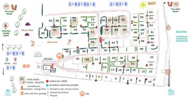
We rent 73 pitches. The map retains the old numbering up to 83 (convenient for regular customers). Several numbers have therefore disappeared. The map is not drawn to scale exactly. If you have any questions about the pitches, please contact us. The camping area incl. car parks measures 2 hectares.
On the left of the map is the entrance and exit to the campsite
- This is on a dead-end street with therefore very little car traffic.
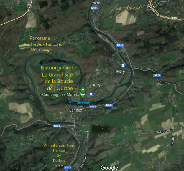
- At the exit to the right, at 350m, is the little station of Hony . A bit further (600m) you will find the artisanal bakery and the bio grocery Al Bètchète in the village of Hony. At the exit to the left you can walk in a few minutes to the swimming dam, which is a gateway to the Boucle de l’Ourthe nature reserve, a great place for hiking and cycling.
To the right of the map, at the back of the campsite, flows the Ourthe.
- On the footpath along the Ourthe to the left, you walk to the village of Hony, e.g. for the bakery.
- To the right you walk to pebble beaches where it’s nice to paddle. If you walk a little further, you also come to the dam that is an entrance to the nature reserve ‘la Boucle de l’Ourthe’. The road takes you back to the campsite entrance.
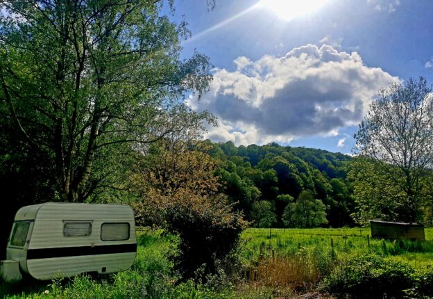
The hikers’ field, at the top left of the map, is mainly for travellers passing through by bike, hiking or by train . It is an idyllic field surrounded by lots of greenery.
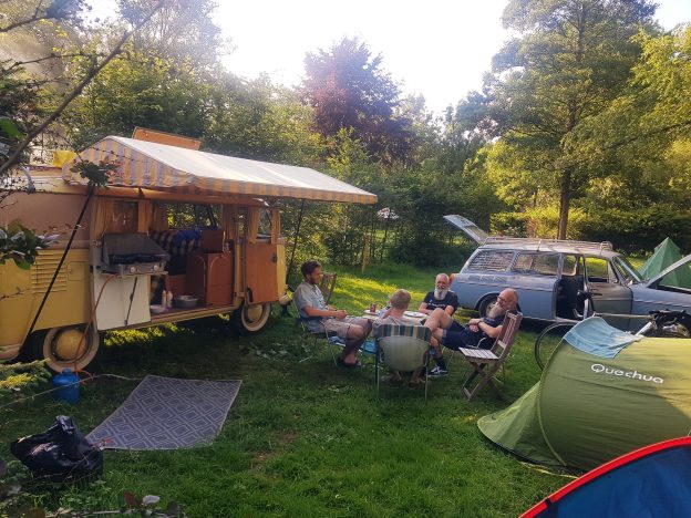
All pitches are spacious and surrounded by lots of greenery.
- 51 standard pitches (60 – 90m2)
- 10 waterfront pitches (70 – 100 m2) on the banks of the Ourthe
- 12 big pitches (100 – 150 m2) – brown coloured
There are shaded and sunny spots. The east where the sun rises is marked on the map. All camping pitches are partially or completely surrounded by various types of hedges that are at least 3 metres high. Most pitches therefore offer privacy and/or shelter. There are trees throughout the entire site.

- You can park a car on the pitch. If you prefer to park it (or a second car) on the car parks, that is also possible.
- There is electricity for every pitch from the red dots on the map (except on the hikers’ field, there is no electricity there). Bring a long extension cord and possibly a connector. We have only a few to borrow. Read more about electricity.
- The blue dots are water points with drinkable water. In the sanitary area, past reception, there is drinkable water from every tap, cold and hot. The chemical toilet and grey water drain are also in the sanitary area.
- Near the entrance are the various garbage containers. In the compost bin you can dispose of (only) raw green waste.
- An info board with hiking and cycling maps and other tourist and practical information can be found to the right of the terrace.
- Always take the same shortest route there and back to your spot. Do not drive around the site in circles, that way we keep the peace.
Read more about the variety of pitches, the hikers’ field, the communal fire pit, the large playing field and the sanitary facilities .